
Audio By Carbonatix
Tullow Ghana, together with its partners, has commenced a 4D seismic survey across the Jubilee and TEN fields, in a significant step towards enhancing its drilling activities for this year and beyond.
The survey, which began earlier this month, is set to run for approximately 45 days, concluding in early March 2025.
The survey will aim to identify the optimal areas for Tullow's next drilling campaign, ensuring sustainable and efficient resource development.
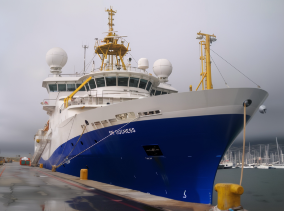
The programme is spearheaded by Norwegian firm Shearwater GeoServices, renowned for its expertise in marine seismic operations.
Shearwater’s advanced vessel, the SW Duchess, is equipped with cutting-edge technology and backed by decades of operational excellence, making it the perfect choice for this complex task.
In a demonstration of local collaboration, the survey is being carried out in partnership with Ghanaian company Destra Energy.
This partnership underscores Tullow Ghana’s commitment to creating opportunities for local participation in the oil and gas value chain.
Recognizing the importance of community involvement, Tullow Ghana and its partners conducted extensive stakeholder engagements before launching the survey.
Meetings were held with key stakeholders, including the Petroleum Commission, representatives from the Canoe Council, the Ghana Navy, the Ghana Marine Authority, local contractors, and other key groups to ensure smooth operations and address potential concerns.
A particular focus was placed on engaging fishing communities along the affected areas to raise awareness about the survey’s activities.
This proactive approach was designed to prevent any interference with fishing canoes and protect marine wildlife, safety and the environment.
Tullow Ghana Managing Director, Jean-Medard Madama said, “We are excited to embark on this programme ahead of our next drilling campaign.
"It will be the first 4D seismic campaign in Ghana's waters and is expected to generate significant data information and insights that will prove crucial for planning efficient drilling operations and maximising resource recovery.
"We have also taken care to engage all relevant stakeholders in line with our commitment to safety and sustainability to ensure maximum success in the seismic campaign in Ghana.”
A 4D seismic survey is a sophisticated technique used by energy companies to gain a detailed understanding of reservoirs beneath the seabed.
It seeks to capture high-resolution images to help pinpoint areas rich in oil and gas to aid operational works offshore.
Latest Stories
-
Lyrical Joe inspires resilience on new single ‘Free Minds’ featuring King Paluta
7 minutes -
Black Stars need time to adapt to Queiroz’s philosophy — Jordan Ayew
49 minutes -
Black Stars lost organisation after Senaya’s injury – Carlos Queiroz
1 hour -
Ghana’s World Cup dream ends as Arias fires Colombia into last 16
2 hours -
NDC signs cooperation accord with Russia’s United Russia Party
2 hours -
Taylor Swift and Travis Kelce wed in NYC in ceremony officiated by Adam Sandler
3 hours -
NDPC discusses proposed Black Star Stadium project with Western Regional Minister
3 hours -
NDPC begins review of planning guidelines to strengthen regional and district development coordination
3 hours -
16% of Accra’s drainage buffer zones lost to encroachment — GARID
3 hours -
Akufo-Addo urges African youth to champion education for continental transformation
4 hours -
Russia looks to students to make up for mounting losses in Ukraine
4 hours -
Argentina survive Cabo Verde scare to book Egypt date
5 hours -
Ati-Zigi, Inaki, Opoku return as Queiroz makes four changes for Colombia clash
5 hours -
MTN Ghana Awards GH¢30,000 to SME Pitch Winners.
5 hours -
48,000 displaced by Accra floods as government scales up relief operations — Mahama
6 hours