
Audio By Carbonatix
With Ghana’s natural resources under increasing threat from illegal mining, climate change, and deforestation, a new training program at the Kwame Nkrumah University of Science and Technology (KNUST) is equipping young scientists with the tools to safeguard ecosystems using remote sensing technology.
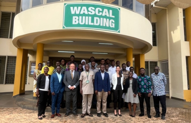
The program, themed “Remote Sensing for Biodiversity Conservation”, was organized by the Earth Observation in Africa: Capacity Development for the Preservation of Ecosystems and Their Services (EOCap4Africa) in partnership with the West African Science Service Centre on Climate Change and Adapted Land Use (WASCAL).
Out of nearly 50 applicants, 27 postgraduate KNUST students were selected to take part.
Over several days, participants will receive hands-on training in biodiversity mapping, open-source GIS tools, and case studies from Ghana and beyond.
Organizers say the goal is to build not only technical expertise but also the next generation of conservation leaders in Africa.
Remote sensing, which involves the use of satellites, drones, and aircraft to monitor the earth from above, is being touted as a powerful tool for conservation.
By tracking forest cover, monitoring water bodies, mapping wildlife habitats, and detecting illegal activities, the technology provides data critical for policymaking and sustainable land use.
EOCap4Africa’s Coordinator, Dr. Insa Otte, stressed that while technology is important, it cannot solve problems on its own.
“Technology alone does not solve problems. Data is only powerful when it is translated into action. This workshop is designed to give students and young researchers the skills to access, analyze, and apply remote sensing data for biodiversity conservation,” she said.
Dean of Civil and Geo-Engineering at KNUST, Prof. Kwaku Amaning Adjei, underscored the urgency, warning that Ghana is not insulated from the global biodiversity crisis.
“Biodiversity loss is occurring globally with negative impacts on ecosystems and human well-being, and Ghana is no exception. Remote sensing offers a powerful lens through which we can observe, understand, and protect our ecosystems,” he emphasized.
Director of WASCAL, Prof. Wilson Agyei Agyare, added that the technology bridges critical information gaps.
“With remote sensing tools, you don’t always need to be on the ground. You can acquire the data, interpret it, and inform policymakers of the damage going on,” he explained.
Organizers say the ultimate goal is not only to build technical expertise but also to prepare the next generation of conservation leaders in Africa.
As biodiversity continues to decline at alarming rates globally, experts argue that initiatives like this are vital to confront one of the nation’s most urgent environmental challenges.
Latest Stories
-
Edmond Boateng takes up secretary role at Honorary Consular Corps of Ghana
1 hour -
Gambia appoints British barrister to prosecute gruesome Jammeh-era crimes
2 hours -
Girl group Flo on entering into their ‘bombastic, confident, strong’ era
2 hours -
Germany suspends military approval for long stays abroad for men under 45
2 hours -
Liverpool face uphill Champions League task after PSG thrashing in Paris
2 hours -
‘Ketamine Queen’ sentenced to 15 years in Matthew Perry overdose death
2 hours -
Nigeria begins mass trial of 500 terrorism suspects
2 hours -
Atletico Madrid stun 10-man Barcelona to seize Champions League semi-final advantage
3 hours -
Black Stars coach to be announced by next week – Sports Minister
3 hours -
Chiefs, queen mothers and principal elders of Odau group denounce ‘rebellious Etweresohene’, pledges allegiance to Okyenhene
3 hours -
KNUST library dress code sparks online backlash over strict rules
3 hours -
Cultural Diplomacy in Action: Ghanaian youth leaders present symbolic smock to U.S. Chargé d’Affaires
3 hours -
Ghana Card payment activation under review – NIA breaks silence on financial integration
4 hours -
Ofori-Atta’s ICE release on bail positive; he poses no risk – Amanda Clinton
4 hours -
Ken Ofori-Atta’s passport seized after bail, set to reappear in US Court on April 27
4 hours