
Audio By Carbonatix
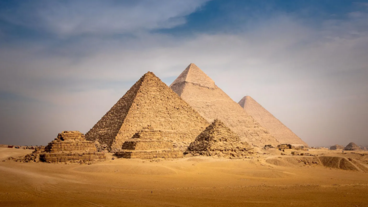
Scientists believe they may have solved the mystery of how 31 pyramids, including the world-famous Giza complex, were built in Egypt more than 4,000 years ago.
A research team from the University of North Carolina Wilmington has discovered that the pyramids are likely to have been built along a long-lost, ancient branch of the River Nile - which is now hidden under desert and farmland.
For many years, archaeologists have thought that ancient Egyptians must have used a nearby waterway to transport materials such as the stone blocks needed to build the pyramids on the river.
But up until now, "nobody was certain of the location, the shape, the size or proximity of this mega waterway to the actual pyramids site", according to one of the study's authors, Prof Eman Ghoneim.
In a cross-continental effort, the group of researchers used radar satellite imagery, historical maps, geophysical surveys, and sediment coring (a technique used by archaeologists to recover evidence from samples) to map the river branch - which they believe was buried by a major drought and sandstorms thousands of years ago.
The team were able to "penetrate the sand surface and produce images of hidden features" by using the radar technology, the study, published in the journal Nature, said.
Among those features were "buried rivers and ancient structures" running at the foothills of where the "vast majority of the Ancient Egyptian pyramids lie," Prof Ghoneim said.

Speaking to the BBC, one of the study's co-authors, Dr Suzanne Onstine, said, "locating the actual [river] branch and having the data that shows there was a waterway that could be used for the transportation of heavier blocks, equipment, people, everything, really helps us explain pyramid construction."
The team found that the river branch - named the Ahramat branch, with "ahramat" meaning pyramids in Arabic - was roughly 64km (39 miles) long and between 200-700m (656-2,296 ft)wide.
And it bordered 31 pyramids, which were built between 4,700 and 3,700 years ago.
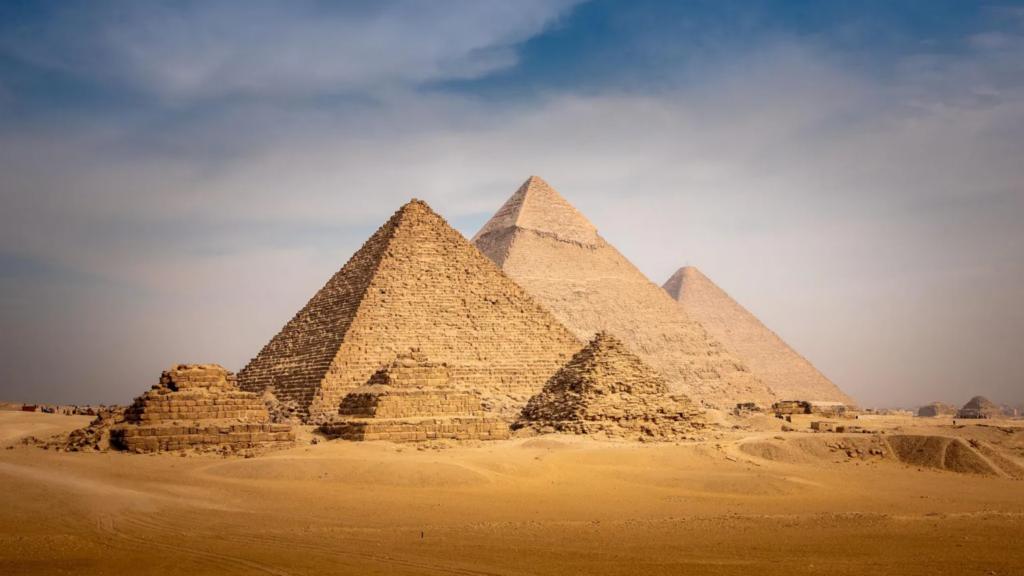
The discovery of this extinct river branch helps explain the high pyramid density between Giza and Lisht (the site of Middle Kingdom burials), in what is now an inhospitable area of the Saharan desert.
The river branch's proximity to the pyramid complexes suggests that it was "active and operational during the construction phase of these pyramids", the paper said.
Dr Onstine explained that ancient Egyptians could "use the river's energy to carry these heavy blocks, rather than human labour," adding, "it's just a lot less effort".
The River Nile was the lifeline of Ancient Egypt - and remains so to this day.
Latest Stories
-
Dialectical Democracy (Part One)
1 hour -
Who owns the child benefit? A family debate that is tearing homes apart abroad
1 hour -
Water crisis cripples learning at Nalerigu SHS as students abandon night studies to search for water
2 hours -
IMF Board set to approve Ghana’s final Programme Review, greenlight post-bailout economic plan
2 hours -
Ghana to deploy condom vending machines nationwide by end of 2026 to boost HIV prevention
2 hours -
NDPC briefs Speaker Bagbin on proposed consolidated national development plan
2 hours -
Presbyterian Church launches Disability Policy, urges members to champion inclusion
2 hours -
GPHA plans sports centre as it marks 40th anniversary
2 hours -
Galamsey affecting fish production in Bono Region – Fisheries Commission
2 hours -
Dambai College of Education appoints new Principal and Vice Principal
2 hours -
Ho West chiefs and queens commend Volta Regional Minister for inclusive leadership
3 hours -
Gov’t invests over GH¢900m under ‘No Stress Free’ initiative – Education Minister
3 hours -
Government committed to revamping cocoa industry – COCOBOD
3 hours -
Mahama assures transfer of UGMC to University of Ghana
3 hours -
Oti High Court adjourns NPP Krachi East Organiser election dispute to October
3 hours