
Audio By Carbonatix
Ghana has begun employing earth observation technologies to monitor its forest resources to understand the extent of deforestation especially by cocoa production.
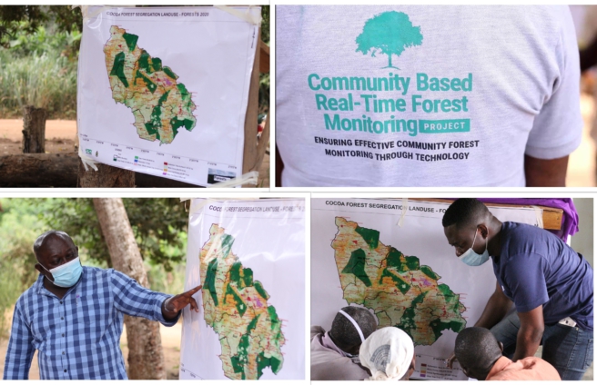
Under the name Forest 2020 Project, the project which seeks to help Ghana understand the rate of deforestation, has been able to segregate cocoa farms from forest areas.
It was a collaboration between UK Space Agency who are the funders, through an organization in the UK called the Ecometrica Limited.
Faculty of Renewable Natural Resources of the KNUST and the Resource Management Support Centre of the Forestry Commission are executing the project in Ghana.
Apart from these two institutions in Ghana, other institutions in the UK such as the University of Edinburg, Cabo Map, and the University of Leicester are part of the project.
Professor Emmanuel Acheampong, Head of Department, Silviculture and Forest Management of the Faculty of Renewable Natural Resources at KNUST is project team leader.
He revealed several efforts to reach this stage has not been successful until 2017 when this project started.
“Over the years we have done forest monitoring but this is a comprehensive project that helps us to build capacity to monitor our forest resources through the use of earth observation technologies. We have been able to produce a map that segregates forests from cocoa, over the years we have tried it but it hasn’t worked.”
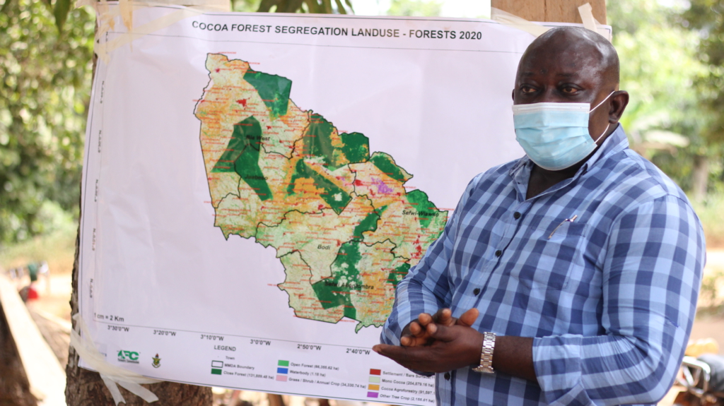
He continued that, “One of the key output is that we have been able to segregate cocoa from forest areas. It is very important because we know that cocoa production leads to forest lost – deforestation- so once we have been able to segregate. And the basic idea is to build our capacity so that we can continue to monitor the forest.”
Cocoa production is one of the main stays of Ghana’s economy and so the country need to produce but must not be done at the expense of the country’s forest resources.
The cocoa industry has committed to deforestation free cocoa production and so this project is very key for them.
“So it is very important output for the forestry commission of Ghana in terms being able to monitor the forest resources in terms of cocoa deforestation.
In the long term, we are expecting that we will produce cocoa without compromising the integrity of our forest resources. So in the long term we will be able to produce cocoa and at the same time prevent forest loss,” Prof Acheampong explained.
So with this, the country is able to tell in the coming years whether cocoa is eating into forested areas or not. Not only cocoa from the forest, the project also further was able to segregate agroforestry cocoa from monoculture cocoa.
The Alert System
One of the many critical things the project revealed was the continuous wild encroachment of the forest reserves.
The Project team there has developed an alert system which is meant to address this menace right from their offices by producing signals of encroachment in the forest reserves.
The alert system combines satellite images, remote sensing applications, ground trudging and community inputs and interactions to confirm alert then action is taken.
“What is important about this is that we have developed an alert system so anytime there is encroachment we can pick the signals and trace the encroachment and see to it that we address it before it escalates”,Yakubu Mohammed, Head of Geo-Information Unit at RMSC-Forestry Commission and Principal Investigator for Forests 2020 Project, revealed.
He continued that after the alert signals are picked, the team will have to under what type of encroachment alert it is before the appropriate solution is professed.
“So we sit in the office look at the current satellite images on daily basis, weekly basis, monthly basis, then we pick out the alert, and then quickly trace out the alert to the ground and find out the nature of the alert; is it as a result of timber harvesting, as a result of farming or settlement and when we pick up these signals then we find a way of addressing them”.
The Project
This project was meant for three years which ends this year but due to the impact of the corona virus, it has been extended till March, 2021, within which period, they must finalize the outputs.
Professor Acheampong explains that the expectation is for the forestry commission to take over this once the project ends and the outputs are handed to the forestry commission.
“Through the RMSC, they will be able to carry this forward so that may be every year, two years or even every four years, they can collect data to update the map that we have produced.”
He continued that continuing the project is very important to produce a national monitoring system to monitor and address the deforestation in the forest areas.
“…this is a very good project and the outputs are very good for Ghana so we expect that the forestry commission will take it over and it will not be like any other project when it ends everything stops.
So that we can have a national monitoring system where we can continue to monitor our forest resources so that we can have better management of the resource.”
Validation Exercise
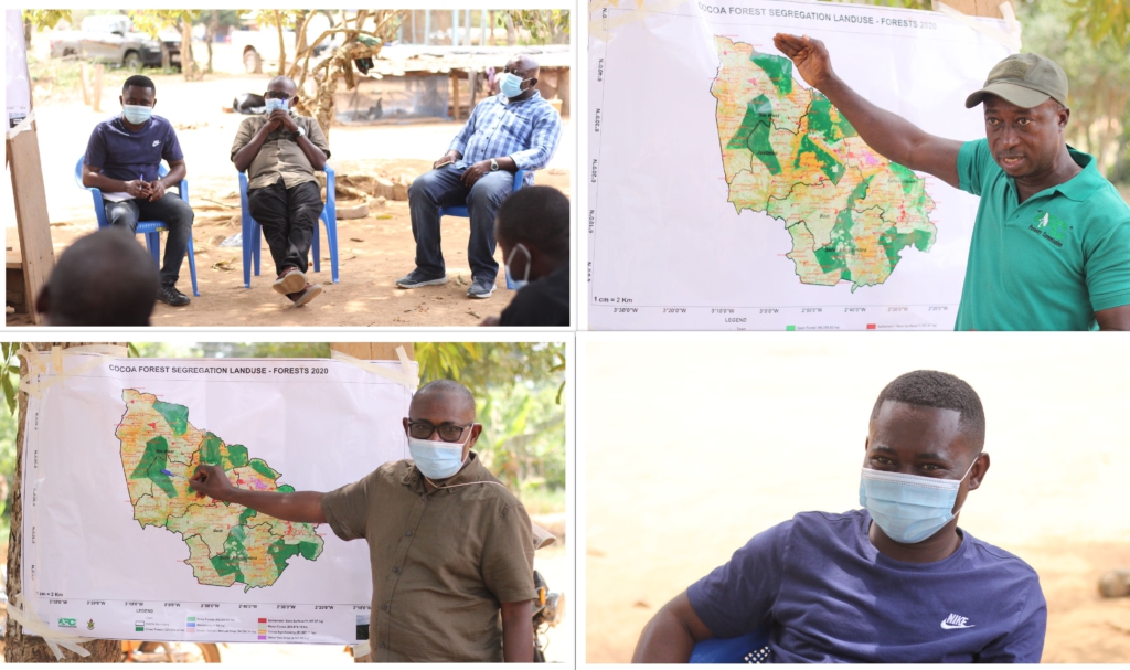
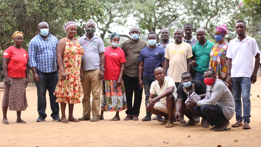
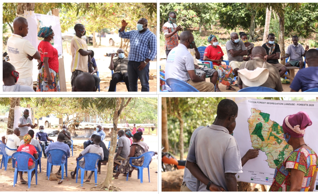
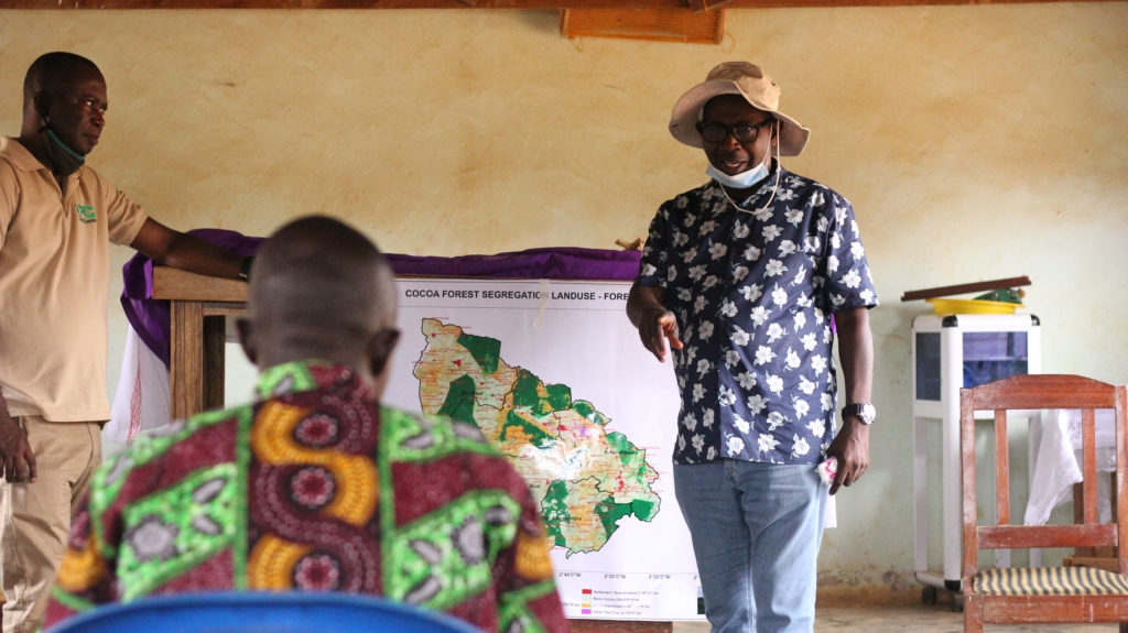
The project team to effectively complete the project has been visiting the forested communities in the Western Regions to validate the generated maps.
They met with community leaders, opinion leaders, assembly members and residents of communities in these communities and displayed the map to them.
Community members gathered took turns to either confirm or deny the content of what the earth observation technologies had produced.
These communities are Sarfo Junction, Anwiafutu, Asafo Adjei, and Ntonsue. Others include Wansambirampa, Wansampo, Attakrom and Old Adiembra, all in the Western North Regions.
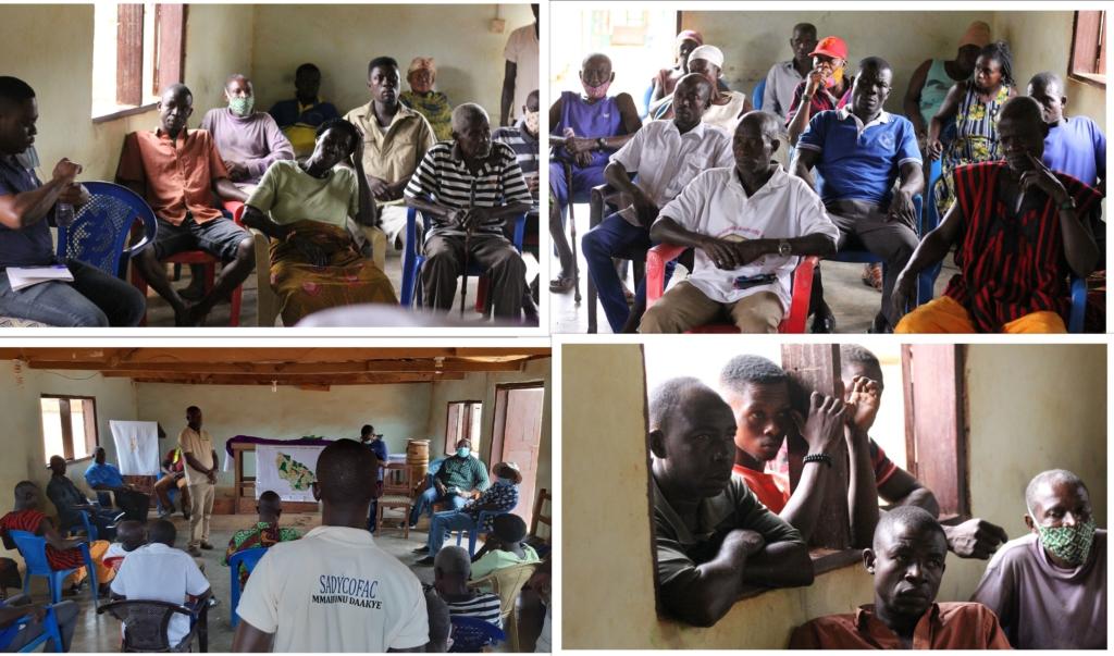
Some of the community leaders explained it was the first time they had seen such an exercise take place which was accompanied by explanations for their understanding.
“Since we lived here, we have neither seen nor heard anything like this Map before. We are very grateful. Though we hear the forest is being depleted, we now understand how serious it is after this exercise,” Chief of Ntonsue, revealed, “We will however plead that you continue updating us so that those who come before us will understand the situation as well.”
Another chief, Nana Kwadwo Adjei, Chief of Wansampo in the Sefwi Akontommira district of the Western North Region, said, "We are grateful for this Map they have shown us and the education they have given us. We thank you for bringing the map here,”
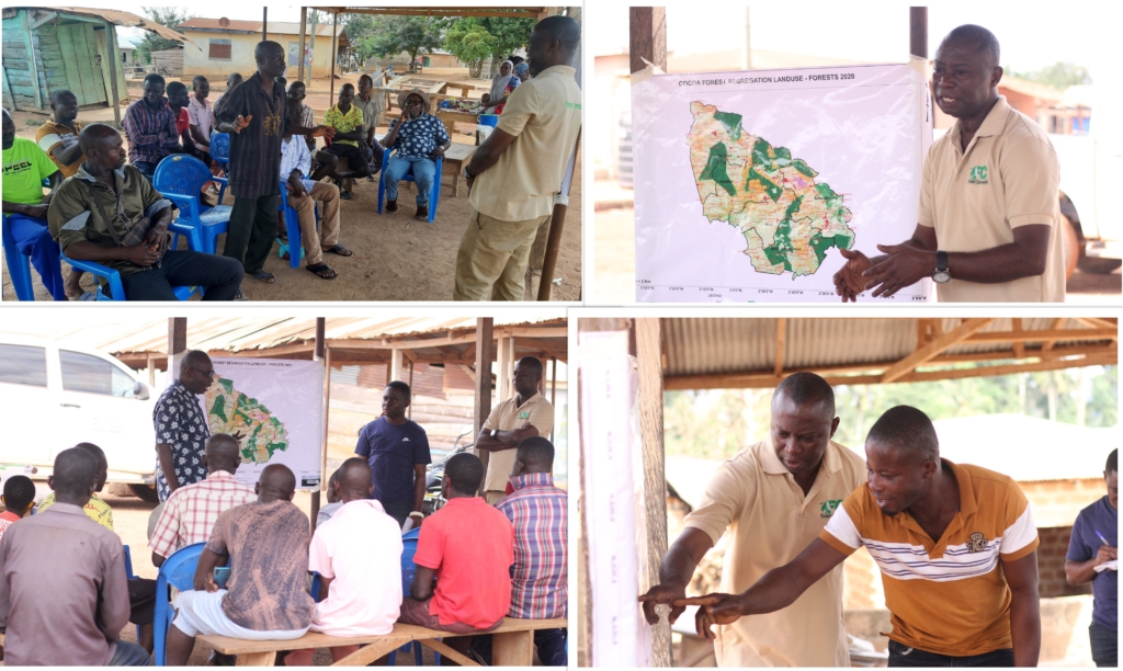
Some of these communities engaged had by settlement encroached some parts of the forest reserves among other reasons.
Nana Adjei, however, advised his community people to take all the advice the forestry and project team gave them so their cocoa crops will do better as well as protect the forest.
GIS/ Mapping Officer and Technical Assistant for Forest 2020 Project RMSC-Forestry Commission, Prince Boama, led the team to explain the map to community members.
The team revealed plans to erect bigger frames of the mapped forest in these visited communities.
Forestry Commission Input
The Forestry Commission has as its main mandate to manage the forestry resources in Ghana. But before one can manage any resource well, one must make sure there is very accurate information about the resource, the current state of the resource is known from what is was, then the trends.
Yakubu Mohammed, Head of Geo-Information Unit at RMSC-Forestry Commission and Principal Investigator for Forests 2020 Project.
He explained that the main input of the forestry commission is the provision of expertise to map the forest resources of the country, determine the extent of our forest resources and look at the disturbance in the forest resource and then generate this data and information.
The information will then be used in the planning resources to ensure that the forest resources are there for future generations.
“The forestry commission is part of the global community, the UNFCCC, currently we are running the RED Plus project, FIP, all these initiative are geared towards protecting the forest resources and they require adequate information about the resources, so the forestry commission is there to provide adequate information to the country, the international and global community,” Mr Mohammed explained.
One of the key objectives of this project is to able to map our forest resources, tease out commodity crops like the cocoa, rubber and others from the natural forests because as a country we have identified that these commodity crops are the main drivers for deforestation because they are also providing sustenance for the local people.
According to him, the situation therefore presents the need to strike a balance between increasing the yield of the crops as well as maintaining the natural environment or ecosystem.
“…So in that case, we are looking at a way out of getting our forest intact as well as increasing our cocoa productivity.”
The forestry commission is expected to continue with the project after it ends.
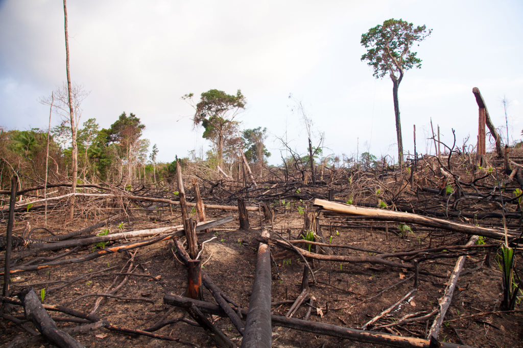
Forest Encroachment
Going round, the team observed that though cocoa thrives well under forest canopy, most of the cocoa in the project areas were now grown under monoculture where there is no canopy.
The cocoa farmers are complaining the gestation period of cocoa has reduced drastically in other words; that cocoa doesn’t take long, within ten to fifteen years and they die.
“In the past from going round, some of the cocoa could stay long at hundred years but now it has come down to ten to fifteen year and because the cocoa farms doesn’t stay long the farmers turn to look for new areas to crop
The new areas available now are the forest reserves and so we noticed that going round and displaying our maps we see a lot of encroachments in our forest reserves”, said Yakubu Mohammed.
So the purpose of this project is to tease out this and find a way of halting the encroachment in the forest reserves which is as a result of cocoa farming.
The team has now benefited from upgraded skills training to execute this task.
“We have learnt so much from it, we have had training because five years back we didn’t have the skill to tease out commodity crops from natural forests, and anytime we generated a map we lumped up the natural forest and the tree crops.
Now we have the skill so every year we can reproduce this map and look at where encroachments are taking place”.
Professor Acheampong added that this project holds the potential to mitigate the impact of climate change on the environment.
“We know that climate change has impact on cocoa production, and so by this project we are able to reduce deforestation by extension it will have effect on climate change. At least at the rate at which the climate is changing, the project can slow it.”
Annual cocoa production consistently for about five years now keeps declining, and this is partly explained as the reduced shady trees in the cocoa farms.
Professor Acheampong is positive the success of this project could contribute to the increased cocoa yields because as part of the project farmers are taught the need to keep canopy crops in the cocoa farms.
“It is our expectation that cocoa production will go up and that will have a ripple effect on the farmers’ income and their livelihoods. Cocoa production has declined and it is partly because there are fewer shade trees in the cocoa farms.”
Latest Stories
-
Daily Insight for CEOs: The CEO’s role in driving innovation
4 minutes -
Greater Works 2026 to bring together global christian leaders in Accra
4 minutes -
The delete button is lying to you — and the reason you trust it is the same reason it knows so much.
9 minutes -
University of Ghana’s WACBIP marks 10 years with renewed focus on innovation
17 minutes -
ISSER raises concerns over sharp decline in capital expenditure
20 minutes -
GFD distances itself from unemployed graduates with disabilities’ protest threat over GES recruitment
30 minutes -
Today’s front pages: Monday, August 3, 2026
44 minutes -
INTERPOL report finds AI linked to more than half of cybercrime in Africa
57 minutes -
GH¢2 billion was collected to clean Ghana. So why is Accra still this filthy?
2 hours -
Sedina Tamakloe Acquittal: Prof Gyampo says corruption fight cannot survive prosecutorial incompetence
3 hours -
Bole-Bamboi MP Yusif Sulemana thanks well-wishers after earning PhD in Business Administration
3 hours -
15 suspected galamseyers arrested near Obuasi school after viral video exposes site
3 hours -
Court of Appeal ignored ‘mountain of evidence’ in Sedina’s acquittal – Alfred Tuah-Yeboah
3 hours -
Minority Leader criticises government over governance, economy and tribunal law
3 hours -
Unemployed Graduates with Disabilities give government one-week ultimatum over GES recruitment
3 hours