
Audio By Carbonatix
The Ghana Boundary Commission and the Minister responsible for Lands and Natural Resources are expected to appear before Parliament’s Select Committee on Lands and Forestry when parliament resumes sitting.
The invitation is for the two to provide answers on the exclusion of the Surveying and Mapping Division of the Lands Commission from the governing board of the Ghana Boundary Commission.
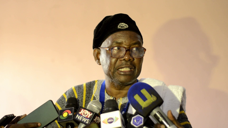
Chairperson of Parliament’s Select Committee on Lands and Forestry, Francis Manu-Adabor, has observed that the decision to exclude the state institution mandated to oversee land management in the country is inappropriate and insists on their inclusion.
He spoke to the media at the National Retreat of Surveying and Mapping division of Lands Commission held in Kumasi.
“Whatever they do as Commission, I think someone from the Survey and Mapping Division should be part. If they say somebody from the Ghana Institute of Surveyors, we have three different divisions there. There can be a valuer, an architect and a one surveyor, but that expert should be a land surveyor. He should go in there and see to the practices, make sure all the inaccuracies and everything is taken care of before they go out and do the boundary demarcation. So I will invite the Executive Secretary of the Lands Commission, the Boundary Commission, and the Minister to iron out these issues. I am not saying what they are doing is not right, but there are qualified surveyors and their work must be controlled by the director of Survey,” he said.
The Ghana Boundary Commission was established by an Act of Parliament to demarcate, delimit and manage Ghana’s international and internal boundaries.
The 15-member governing body chaired by the Lands and Natural Resources Minister does not include the Surveying and Mapping Division of the Lands Commission, but the Ghana Institute of Surveyors.
Chairperson of the Committee, Francis Manu-Adabor, believes certain boundary operations must be controlled by the Lands Commission.
“It was there, but they were working under the Surveying and Mapping Division of the Lands Commission. The director of Survey had complete control of the Mapping they do at the boundary, because at the boundary we can’t compromise one inch of land which can bring confusion,” he said.
The 2023 national retreat of the Surveying and Mapping Division of the Lands Commission brought together surveyors across the country to deliberate on adopting measures to digitalise the sector.
The MP warned the surveyors against working with unqualified surveyors who are denting the image of the profession.
“There are so many quack surveyors out there and some of you people know them and work with them. So how can we protect the profession.? If the Surveying and Mapping Division fails, the Lands Commission fails because all the other divisions use your data to work,” he said.
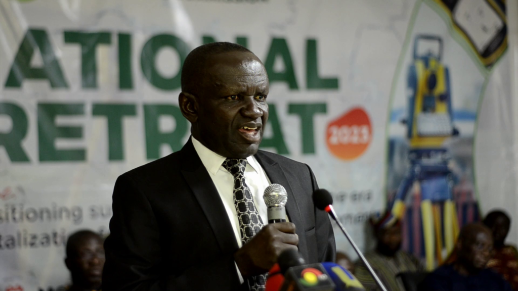
Director of Survey at the Lands Commission, Naa Abukari Abudulai, believes a review of existing laws on mapping and surveying could smoke out quacks in the profession.
“We’ve had a lot of land disputes in all sectors of the court, largely because wrong people go in to do wrong surveys, to do registrations, and want to sell lands when they don’t know where the lands are. So it is only our laws that will be able to deal with such people in such a manner that others won’t learn from it,” he said.
The resurgence of boundary disputes continues to wreck havoc in communities.
Paramount Chief of Asante Akyem-Domeabra, Baffour Owusu Bediako wants the institution to work to resolve communal disputes.
“Intra and inter-tribal conflicts are leading to loss of lives and properties. Technological advancement gives us the opportunity to charter a new path in the practice of survey in the country. It is my earnest prayer that the outcome of this all-important meeting will lead to a great transformation in survey practice and improve efficiency and productivity in land management in the country,” he said.
The 2023 national retreat of the Surveying and Mapping Division of the Lands Commission was held under the theme, “Repositioning Surveying and Mapping in the era of Digitalisation for Socio-Economic Development.”
The Division called on the government to support them with resources as they strive to digitalise the surveying industry.
Latest Stories
-
Church of Pentecost supports over 2,000 BECE candidates in Obuasi with career guidance seminar
12 minutes -
Brandon Asante and Coventry all but promoted to Premier League despite Sheffield Wednesday draw
34 minutes -
GPL 2025/26: Late Kwartemaa strike downs Hearts in Tema
40 minutes -
Ghana Faces Sierra Leone Moment as Prosecutorial Powers come under strain
50 minutes -
Don’t consume fish or seafood from Tema Shipyard until further notice – FDA warns
55 minutes -
Why volunteering might be Africa’s most underrated career accelerator
1 hour -
ActionAid Ghana raises concern over gender gaps in Feed Ghana Programme
1 hour -
Windstorm wreaks havoc in Gushegu, displacing nearly 2,000 residents and damaging schools
1 hour -
Friends of Bridget Bonnie Marks her 35th birthday with donation to Kasseh Model Health Centre
2 hours -
From Ekumfi Kokodo to the Pulpit Stage: Essi Donkor’s gospel journey takes shape
2 hours -
Landfilling waste management creates no value, it’s an economic waste
2 hours -
Photos: Speaker Bagbin Commissions MPs constituency office under parliamentary decentralisation programme
3 hours -
Black Stars technical advisor Winfried Schäfer sacked as GFA shakes up backroom staff
3 hours -
Wenchi water project almost complete, critical to gov’t agenda – GWL MD
3 hours -
Anti-LGBTQ+ bill not part of government’s legislative agenda – Inusah Fuseini
3 hours