
Audio By Carbonatix
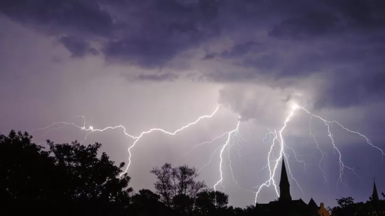
Thunderstorms, winds and hail are forecast to sweep across the UK this weekend and could cause flash flooding, the Met Office has warned.
It said warm, humid air this week has caused the storms to develop.
A yellow weather warning for England and Wales is in place for Sunday, with an unsettled weekend of weather on the way for some.
But the hot weather will continue, with temperatures reaching highs of 29C (84F) in some areas.
The storms could also lead to power cuts.
There is a chance homes could be flooded quickly as some areas see up to 30mm of rainfall in an hour, the Met Office said.
BBC Weather meteorologist Matt Taylor said on Saturday it was the western half of Northern Ireland that was most likely to experience thunderstorms, with a yellow warning issued for the area between 14:00 and 21:00 BST.
A yellow warning is the lowest of three warnings the Met Office can issue and means there could be some disruption to travel in a few places.
Mr Taylor said: "There's an increasing chance of thunderstorms developing across the UK and Ireland through the weekend, as humidity levels continue to rise.
"On Sunday, more of us could see the chance of some severe storms developing, with the Met Office having issued a yellow warning widely across Wales and most of England for the entire day.
"Storms are most likely to develop from late morning onwards, with the risk of frequent lightning, hail, strong winds and some flooding leading to disruption.
Mr Taylor added that some of the worst storms could result in more than a month's worth of rain in just a few hours, leading to flash flooding.
However, he said that not everyone will see the storms, with conditions "highly variable over just short distances, and many areas remaining dry".
Late on Sunday, and into the night, the thundery rain could affect more of northern and eastern England, as well as eastern Scotland, he added.

The stormy forecast follows a week of high temperatures, where many parts of the UK officially experienced a heatwave.
Heatwaves are becoming more likely and more extreme because of human-induced climate change.
The world has already warmed by about 1.2C since the industrial era began, and temperatures are expected to keep rising.
Despite the storms, the heat is set to continue. The highest temperature of the year so far was at Chertsey Water Works in Surrey on Saturday where highs of 32.2C were recorded.
A hosepipe ban was issued in Kent and Sussex on Friday after South East Water said it had no choice after demand for drinking water reached "record levels" in June.
Up to 4,000 customers are without water or have been experiencing low pressure since Monday due to supply issues.
Latest Stories
-
Tunisian journalist sentenced to two years, union denounces systemic attack on media
32 minutes -
Nigerian lawmakers approve increased $49.4bn 2026 budget
42 minutes -
Nigeria allocates more crude cargoes to Dangote refinery for May, sources say
52 minutes -
Senegal president backs new anti-LGBT law banning ‘promotion’
1 hour -
Nigeria warns its citizens in South Africa to be cautious after march turns violent
1 hour -
EOCO declares Dr Kwamigah-Atokple wanted in gold fraud probe
1 hour -
Police arrest suspects in cybercrime, violent cases
2 hours -
Adenta Court fines students for assault on teacher
2 hours -
Accra Circuit Court probes alleged online fraudsters
2 hours -
Global refinery giant eyes Ghana as gold processing hub – Sammy Gyamfi tells Joy News
2 hours -
By 2030, no raw gold leaves Ghana – Sammy Gyamfi reveals Mahama’s bold directive
2 hours -
Raw gold exports declining as Ghana shifts to refining agenda – Sammy Gyamfi
3 hours -
It has already started – Sammy Gyamfi says shift from raw gold to bullion is underway
5 hours -
Czech Republic deny Denmark in shootout to reach World Cup
5 hours -
Sacking Otto Addo was in Ghana’s best interest – Kurt Okraku
5 hours