
Audio By Carbonatix
China and India on Monday agreed to stop sending more troops to their disputed border in the Himalayas, following an escalation in tensions between the two nuclear powers.
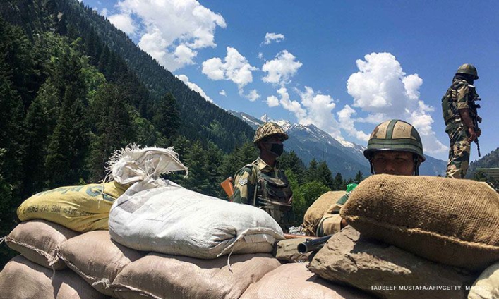
Indian and Chinese senior military commanders met on Monday to discuss stabilizing tensions along the Line of Actual Control (LAC), the loosely defined demarcation line that separates the two countries.
In a joint statement, both sides agreed to strengthen communication on the ground to avoid misunderstandings or action "that may complicate the situation."
They also agreed to not take any unilateral action that would change the situation on the ground, according to the statement. Another round of high-level military meetings will be held "as soon as possible," the statement said.
Tensions have been rising in the Himalayas since a bloody clash between Indian and Chinese troops in June and efforts to deescalate in the wake of the violence appeared to be faltering.
At least 20 Indian soldiers were killed in that incident, the deadliest border conflict with China in over 40 years. China has never acknowledged any casualties from that clash.
Meetings were immediately set up between top Chinese and Indian military officials, and both sides called for calm, but in early September both New Delhi and Beijing accused each other of illegally crossing into their territories, leading to a renewed bout of saber-rattling on both sides.
A week later, China and India accused each other's troops of firing warning shots across the Sino-Indian border, reportedly the first such case in more than four decades. Both sides blamed the other for violating bilateral agreements and taking "provocative" actions.
India and China share a 2,100 mile-long (3,379-kilometer) border in the Himalayas, but both sides claim territory either side of it.
The most recent dispute was around Pangong Tso, a strategically located lake some 14,000 feet (4,200 meters) above sea level that spans an area stretching from the Indian territory of Ladakh to Chinese-controlled Tibet, in the greater Kashmir region, where India, China and Pakistan all claim territory.
The Line of Actual Control, which marks the de facto border and passes through the lake, was established in the wake of the 1962 Sino-Indian war.
Though it shows up on maps, India and China do not agree on its precise location and both regularly accuse the other of overstepping it, or seeking to expand their territory.
In 1996, the two countries signed an agreement which states that neither side shall open fire within 2 kilometers (1.24 miles) from the LAC to "prevent dangerous military activities."
Latest Stories
-
Leila Djansi questions NFA’s appeal for Film Fund donations
8 hours -
The ‘Our Day’ Dilemma: A cherished Ghanaian tradition that has become a high-pressure cooker
8 hours -
UHAS celebrates 2026 International Day
8 hours -
Maison Yusif launches ‘The Beast’ fragrance, eyes global expansion from Ghana
10 hours -
NSMQ 2026 : St. Louis SHS returns to nationals after thrilling comeback in Ashanti region qualifiers
11 hours -
“Data is the new gold” – Prof. Kwofie leads charge for AI-driven, equitable Africa
11 hours -
Lights for Life Movement urges fixing of faulty traffic lights to save lives
11 hours -
Doctor uses cash reward of GH¢20,000 to equip Paga Hospital
11 hours -
Free but expensive education in Ghana – Free SHS in retrospect
11 hours -
Justice must heal a nation, not become a weapon of revenge
11 hours -
Six students injured as fire destroys House Master’s apartment at Leklebi SHS
11 hours -
Mid-Year Budget Review: What happened to the GH¢40m promise to Ghana’s creative industry?
11 hours -
Tafo Government Hospital children’s ward 85% complete ahead of my 45th birthday – Nana B
12 hours -
Kessben FM yanks DJ K.A. ‘off air’ over intimate video circulated online; Investigation underway
13 hours -
Ghana, Nigeria commit to stronger trade cooperation under AfCFTA
13 hours