
Audio By Carbonatix
In this age of technological advancement, Geographic Information Systems (GIS) have become a reliable means to address some of the challenges of deforestation. Combined with cutting-edge remote sensing technology (satellites and drones), data collection tools like GPS, advanced hardware, AI-machine learning algorithms and skilled personnel, can be used to tackle activities that accelerate forest change head-on.
This year’s International Day of Forests has been celebrated under the theme ‘Forests and Innovation: New Solution to a Better World.’ This is a call for us to use technology to drive positive change and sustainable practices within the forest sector.
Innovation becomes essential as we seek solutions to the pressing challenges of deforestation. It involves finding novel approaches, technologies, and strategies to enhance forest management, conservation, and restoration.
GIS and Remote Sensing enable observations over vast areas including forests, without physical contact with the study area. In specialised cases, they may facilitate the extraction of forest/tree stand information such as tree canopy (for modelling Diameter at breast height-DBH), and height estimation. These are key parameters for biomass and carbon computations using allometric equations.
By undertaking rigorous spatial analyses of areas of interest (AoI) e.g. forested areas, the capability of detecting forest changes (deforestation or afforestation) is enhanced to support further decision-making.
Forest change can usually be detected based on the extent of coverage and the period when it occurs; scale and intensity are very important. Therefore, spatio-temporal and spectral resolutions are key in determining the remote products to use particularly for detecting or conducting Land Use and Change Analysis (LUCA).
This analysis enables you to carry out vegetation change detection over a specified period. For example, two different image products from 2000 and 2020, when analysed, can provide insights into forest cover changes over a 20-year period, which could guide policy interventions in an area of interest.
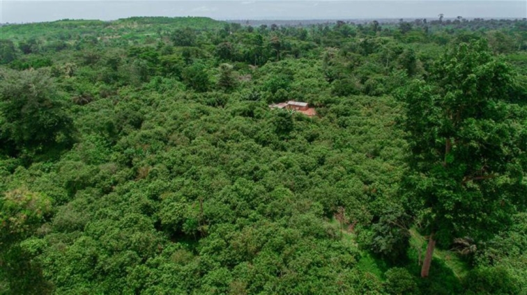
Recently, our Proforest Africa team was able to detect a decline in forest area coverage resulting from illegal mining operations in one of the forest zones in Ghana. Hitherto, a physical presence on-site presents the beautiful scenery of a good forest when driving by, but the changes (mining operations) take place in the heart of this reserve. Initial observations made by using freely available sentinel 2 satellite (10m resolution) imagery aroused curiosity, which was followed up with drone surveys with Very High Resolution (VHR) outputs to confirm that some mining activities were ongoing. These tools gave us a better insight into the massive degradation within that forest area.
Furthermore, they can be used as spatial decision support systems to help in prioritising where development can take place and where conservation efforts can be improved. This helps to identify and map different zones for different purposes to enhance the drive towards sustainable climate initiatives.
In agriculture, for example, we can conduct suitability analysis to determine whether a land is fit for agricultural purposes and identify which crops will be suitable. Across West Africa, Proforest has supported some countries to develop soil suitability maps based on spatial data and field observations. We established that specific crop types would be suitable for cultivation based on the soil properties identified and made recommendations to the relevant authorities.
This is to help them guide the future allocation of land to agro-commodity producers. Statistics show that degradation is mainly driven by agricultural purposes; if we identify crop suitability in the example above, we can increase our yield per hectare without further degrading our forests.
Additionally, yield within a value chain can be estimated and mapped. Let’s say I own a 5-acre cocoa farm. If it is mapped with coordinates and total tree density to estimate crop yield, this will help estimate the total yield expected from my cocoa farm.
So, if all cocoa farms or any other agro commodity are mapped, it can easily help to determine the expected annual yield to be able to trace diseased commodities and identify any anomaly within the value chain.
With increasing tools, we need to build capacity for these technologies by training more experts in both the public and private sectors. The benefits of these tools are enormous, including saving time and cost, and they also enhance the effective allocation of available resources.
A new generation of geospatial experts in Africa is leveraging existing remote sensing data, mostly freely available (Sentinel 2, Landsat) or drones to support spatial decision-making processes.
Harnessing the benefits of GIS and Remote Sensing science and technology is necessary for developing countries to enhance decision-making for development whilst meeting global sustainability targets. Given that it helps to model vast areas in a limited time compared to physical site visits, more investments should be made in building capacity and acquisition of the needed hardware and software.
Deforestation or the risk of deforestation can be detected relatively easily and addressed whilst optimising food productivity and availability using spatial systems. This can greatly enhance terrestrial carbon sinks and be a big boost for food security on the continent.
About Proforest
Proforest is a global mission-driven organisation, focused on the production base and supply chains of agricultural and forestry commodities including soy, sugar, rubber, palm oil, cocoa, coconut, beef, and timber. We support companies with direct action to tackle environmental and social risks throughout a supply chain. We also work with governments, companies, and collaborative organisations, in order to address systemic issues beyond the supply chain, within a landscape or a sector, to deliver positive outcomes at scale for people, nature and climate.
***
Ekow Nyamekye Tawiah is a Senior Project Manager at Proforest Africa
Latest Stories
-
Germany rail network comes to complete halt nationwide due to IT malfunction
1 hour -
2026 World Cup: ‘They were very compact’ – Rice salutes Ghana after England stalemate
1 hour -
Google’s YouTube settles social media addiction case with teen
1 hour -
E-commerce giant Alibaba sues US government over defence blacklist
2 hours -
Resolute Ghana earn England stalemate
2 hours -
2026 World Cup: Resolute Black Stars hold England as Ghana edge closer to Round of 32
2 hours -
Taekwon Security commended for outstanding role in Mahama’s UK visit
2 hours -
Niger pulls out of International Criminal Court after calling it neo-colonialist
2 hours -
‘It doesn’t add up’ – Minority questions PURC’s tariff increase
3 hours -
High Court affirms ICAG’s sole authority to regulate accountancy profession
3 hours -
A restored banking license difficult to resume operation; once collapsed ends its story
4 hours -
Kojo Mensa-Wilmot – a Molecular Biologist and Parasitologist
4 hours -
THE LAW 101: The burden of proof and the presumption of innocence – Lessons from London
4 hours -
UN says it will evacuate sailors stranded in Strait of Hormuz, as Rubio warns against tolls
4 hours -
Police arrest 186 suspects in major crackdown on human trafficking, organised crime in Ashanti Region
4 hours