
Audio By Carbonatix
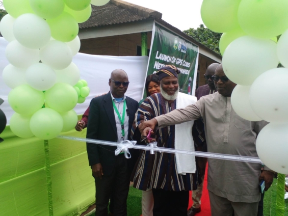
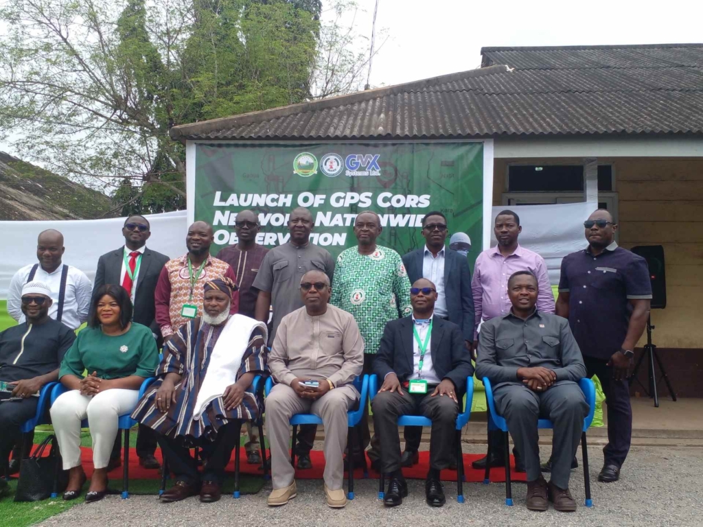
The Lands Commission on Tuesday, August 19, unveiled the Continuous Operating Reference System (CORS) Network to enhance data accuracy of fieldwork and survey operations across the country.
The global positioning system (GPS) CORS Network would provide 24/7 nationwide geospatial data access, ensure real-time centimetre-level accuracy for fieldwork and boost revenue stream for the Commission.
The GPS CORS Network is a collaboration between the Survey and Mapping Division of the Lands Commission, the Licensed Surveyors Association of Ghana and the GMX Systems Ghana Limited, the technical partners for the project.
Currently, 52 COPS Network stations are deployed nationwide and zoned into southern, middle belt and upper sectors.
During the launch of the GPS CORS Network in Accra, Naa Seidu Zakari Abu, the Acting Director of the Survey and Mapping Division, said the deployment of the GPS CORS Network was a game-changer, and a bold step towards modernising Ghana's geospatial infrastructure and strengthening land administration across the country.
He said the integration of GPS CORS Network in survey operations marked a significant milestone in Ghana's efforts to strengthen geospatial data infrastructure.
"Today marks another significant milestone in our collective efforts to strengthen the spatial data infrastructure of Ghana.
As the Survey and Mapping Division of the Lands Commission, in collaboration with the Licensed Surveyors Association of Ghana (LISAG) and our technical partners, GMX System Ghana Limited, we stand committed to ensuring that our nation has a robust, reliable, and modern geodetic framework that meets both present and future development needs," Naa Zakari Abu emphasised.
He noted that accurate spatial data was the backbone of any nation's sustainable development, which underpinned land administration, infrastructure planning, and natural resource management.
It also aids in urban development, disaster management, and ensuring proper utilisation of emerging technologies such as autonomous navigation, he added.
"For us in the surveying and mapping profession, the establishment and strengthening of the National Geodetic Reference Network is not just a technical exercise, it is a national necessity," he stated.
He said further that: "The Nationwide Observation we are launching today focuses on tying over sixty (60) newly established CORS stations to the existing geodetic reference control points and running CORS.
"This integration will consolidate Ghana's National Grid Coordinate System, providing a uniform, consistent, and highly accurate spatial reference framework for all geospatial activities across the country."

The Commission intends to increase the number of GPS CORS stations to 100 by the end of this year to ensure nationwide coverage and operational efficiency.
Dr Samuel Larbi Darko, the President of Licensed Surveyors Association of Ghana, in his remarks, was of the conviction that integrating GPS CORS technology into mainstream survey operations would align Ghana with global standards.
He said: "It will also generate a reliable revenue stream for the Lands Commission through efficiency, trust, and value-added geospatial services.
"We remain committed to densifying the network within the shortest possible time.
“This success rests on strong partnership, sustaining and expanding the network and guaranteeing 24/7 availability of accurate data."
He said he believed the system would ensure every surveyor and stakeholder benefitted immensely, enhance revenue growth for the Commission by building confidence in land records and enabling faster transactions.
Latest Stories
-
Deadly Doses II: Ghana’s drug problem has become a public health crisis – Criminologist says
19 minutes -
Ghana’s borders not for illicit drug trafficking – NACOC warns neighbouring countries
19 minutes -
Three dead and several injured in shooting at food festival near Seattle’s Space Needle
21 minutes -
NYA, French Embassy deepen partnership to boost youth skills development and inclusion
29 minutes -
Ghana in ‘huge crisis’ over addiction care as specialist shortage worsens – Dr Owusu-Antwi
31 minutes -
US and Iran pause strikes for third night to make space for talks, US ambassador says
32 minutes -
When the call sounds genuine: How Mobile Money fraud continues to target Ghanaians
35 minutes -
Deadly Doses II: JoyNews investigation uncovers disturbing shift in Ghana’s growing drug crisis
59 minutes -
NACOC urges public support in fight against illicit drug trafficking
1 hour -
Communiqué: Digital Economy Forum calls for urgent action to protect public trust in Ghana’s cash-lite economy
1 hour -
2026 Commonwealth Games: Azamati through to 100m semis, Botsio out
1 hour -
Gov’t dismisses claims over viral Mahama video, says remarks were taken out of context
1 hour -
Asiedu Nketia and Ato Forson in dead heat for NDC leadership ahead of 2028 – Poll
1 hour -
Wings Over the Sahel: Why Ghana and West Africa must build a drone-ready security doctrine
1 hour -
42 percent of Ghanaians disagree with Abu Trica extradition decision — GlobalInfo Analytics poll
1 hour