
Audio By Carbonatix
Ghana has officially launched a nationwide Global Positioning System (GPS) network that will change the way land is managed, surveyed, and recorded, eventually ending disputes over land across the country.
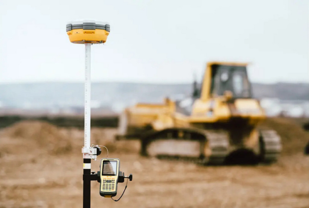
The project, known as the CORS Network (Continuously Operating Reference Stations), was unveiled in Accra on Tuesday, 19th August 2025, by the Licensed Surveyors Association of Ghana (LiSAG) in partnership with the Lands Commission and GMX Systems Ghana Ltd.
The CORS system uses advanced GPS technology to provide real-time, highly accurate data across Ghana, 24 hours a day, 7 days a week.
This means surveyors, farmers, builders, and government agencies can work with centimetre-level precision, far beyond the normal GPS on phones.
The network is being described as a “national game-changer” because it will:
• Make land surveys more accurate, thereby helping to settle disputes over land boundaries.
• Reduce the time and cost of surveys, speeding up the process for people buying land or building houses.
• Protect landowners, ensuring records are reliable and harder to tamper with, giving people more confidence in land ownership.
• Support farmers through precise mapping of farmland and better planning for irrigation and crop management.
• Help in disasters, like floods or earthquakes, by providing accurate maps for quick response.
• Boost development by making it easier to plan and build roads, bridges, and other infrastructure.
• Generate more money for Ghana through faster, more transparent land transactions.
So far, 52 GPS stations have been set up across Ghana. These stations will connect to surveyors and government offices to provide constant, reliable data.
To make sure the system is sustainable, the Lands Commission, LiSAG, and GMX Systems have signed a Memorandum of Understanding (MoU), pledging to maintain and expand the network, ensure 24/7 access, and build public trust in Ghana’s land records.
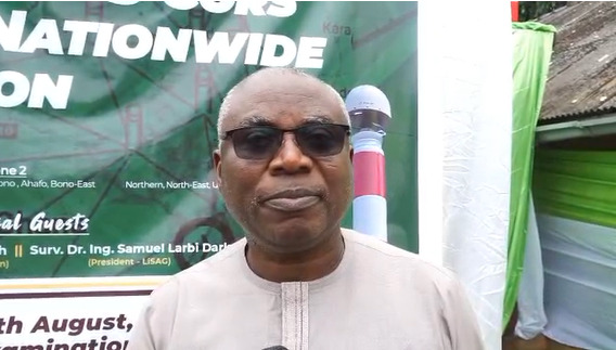
At the launch in Accra, the President of LiSAG, Surv. Dr. Ing. Samuel Larbi Darko, said the CORS Network is more than just a project; “it is a living system, accessible, accurate, and sustainable.”
He added that it answers the government’s call for a 24-hour economy, putting Ghana in line with global best practices in land and geospatial management.
LiSAG has also committed to training more surveyors, encouraging the adoption of the technology nationwide, and working with the Lands Commission to ensure the system benefits every Ghanaian.
At its core, the CORS Network is about making land ownership more secure, making development projects more efficient, and giving every Ghanaian, whether a farmer, a builder, or a landowner, confidence in the country’s land records.
Latest Stories
-
NPP must put aside personal differences to regain power – Paul Afoko
11 minutes -
Government’s fiscal consolidation has suppressed development – Gideon Boako
12 minutes -
Gideon Boako questions government’s economic resilience claims after IMF exit
13 minutes -
Forget the pain and hurt, support me and let’s unite the party – Paul Afoko to NPP
13 minutes -
The right to appeal, the duty to obey court orders, and the legal questions surrounding absconding after conviction
14 minutes -
African Agribusiness Consortium, Jospong announce next batch of 120 Ghanaian scholars for Russia programme
17 minutes -
AAC celebrates return of 118 scholars, reaffirms commitment to transforming Ghana’s agriculture
24 minutes -
PHDC and Touchstone Capital Partners reaffirm commitment to advance US$12 billion Lot 1 agreement
25 minutes -
VADUG urges gov’t to suspend planned vehicle conformity verification programme
32 minutes -
Our democracy is in danger if the NPP is weakened any further – Paul Afoko
47 minutes -
INTERPOL identifies ransomware, AI-powered scams among Africa’s biggest cyber threats
52 minutes -
NPP’s future depends on experience, unity and moving beyond past grievances — Paul Afoko
58 minutes -
Paul Afoko calls for unity in NPP, cites experience and 2016 victory record
1 hour -
Ghanaians lose $1.3m to Mobile Money fraud in first quarter of 2025 – INTERPOL report
1 hour -
IMF exit has exposed Ghana’s economic challenges again – Gideon Boako
1 hour