
Audio By Carbonatix
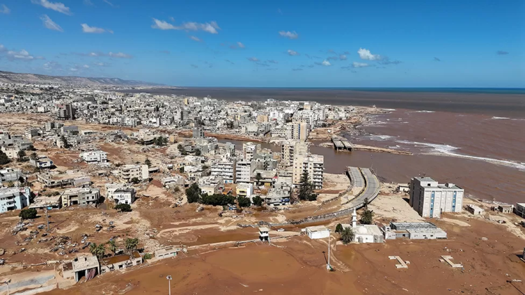
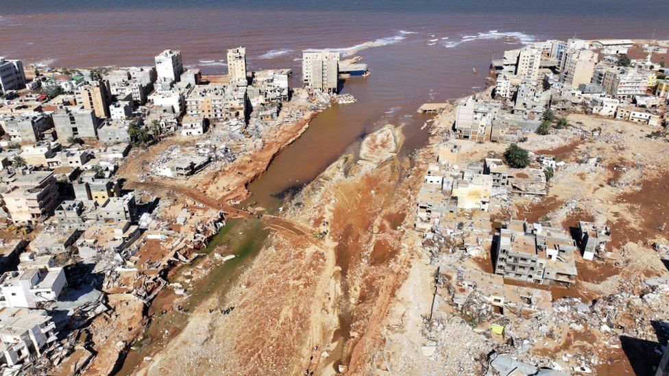
Satellite images show the scale of destruction in the Libyan port of Derna after floodwaters swept away bridges, streets and communities - leaving thousands of people missing or dead.
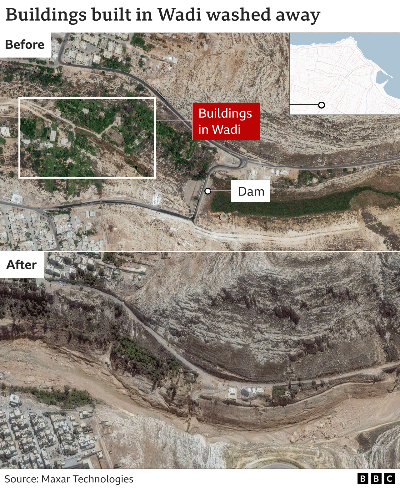
Heavy rains brought by Storm Daniel at the weekend caused two dams to burst on the usually dry Wadi Derna riverbed running through the city. The torrents of water and debris left a trail of devastation.

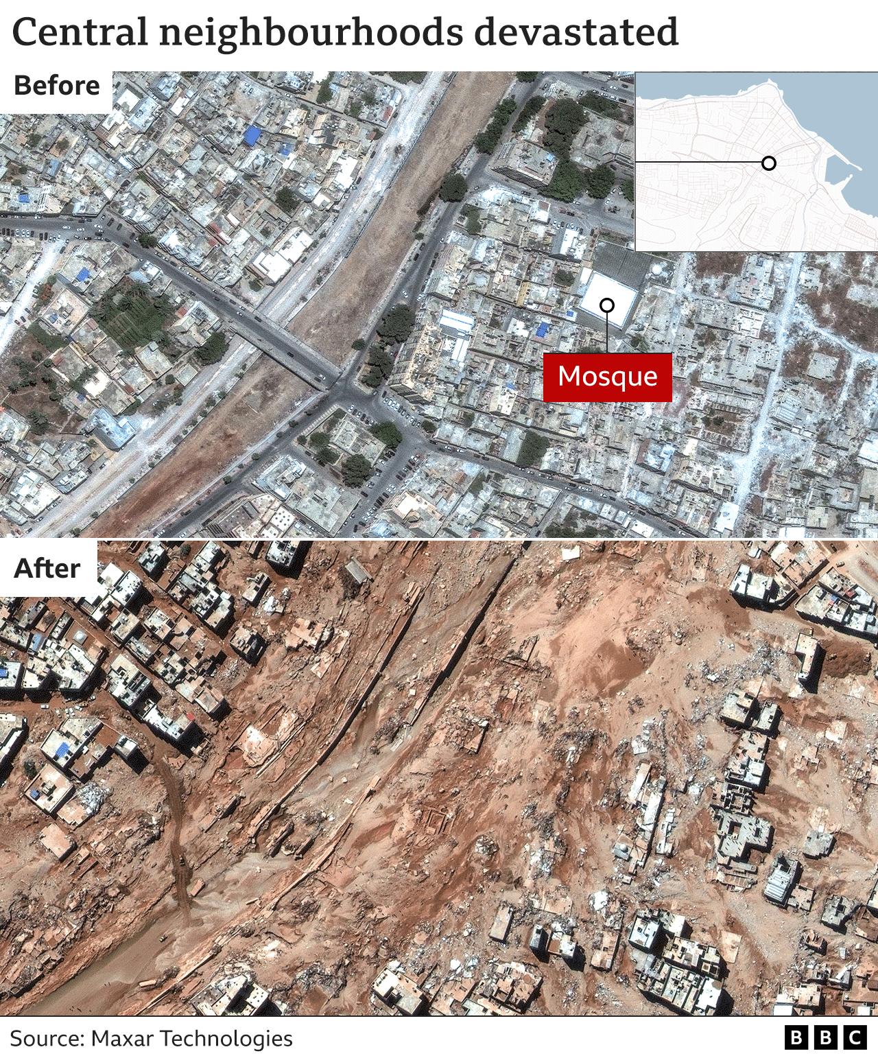
A series of bridges had crossed the Wadi, connecting the port area with the western side of the city. The waters - which one official described as "like a tsunami" - swept away the bridges and whole blocks of buildings along the river including multi-storey residential blocks, government buildings and a large mosque.
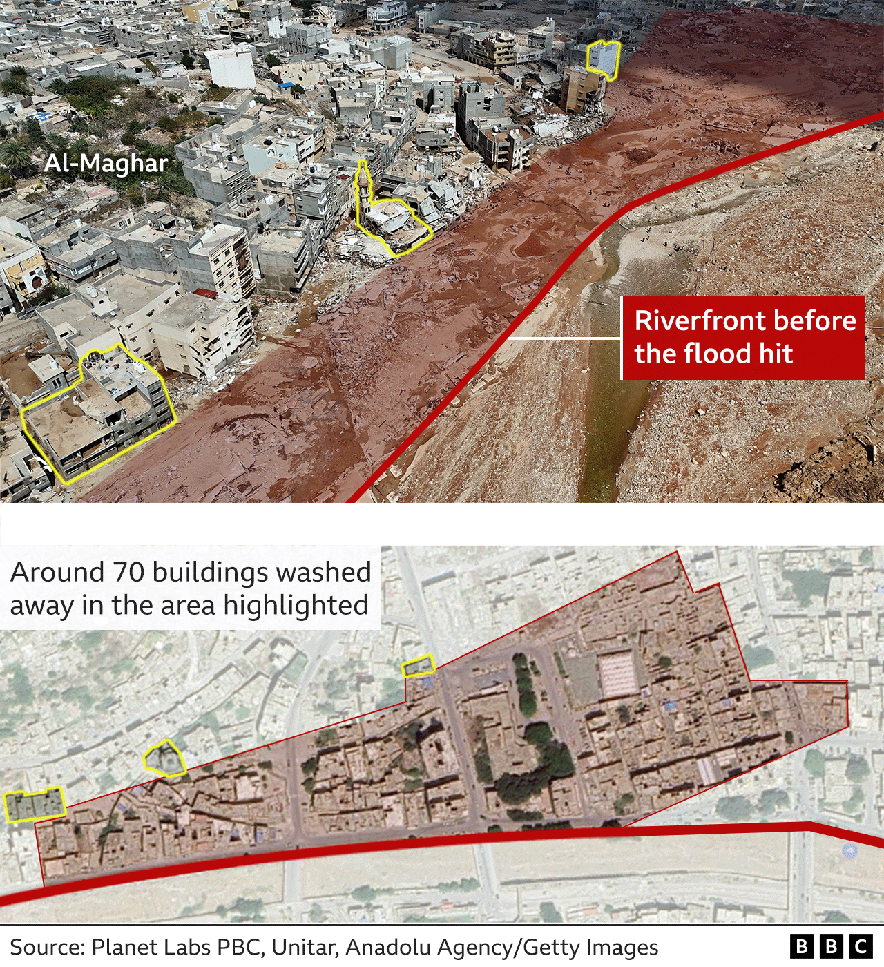
In the nearby neighbourhood of Al-Eilwa, around 96% of properties were reported to have been flooded.
Many properties which stood near the river have disappeared, leaving only their foundations visible.
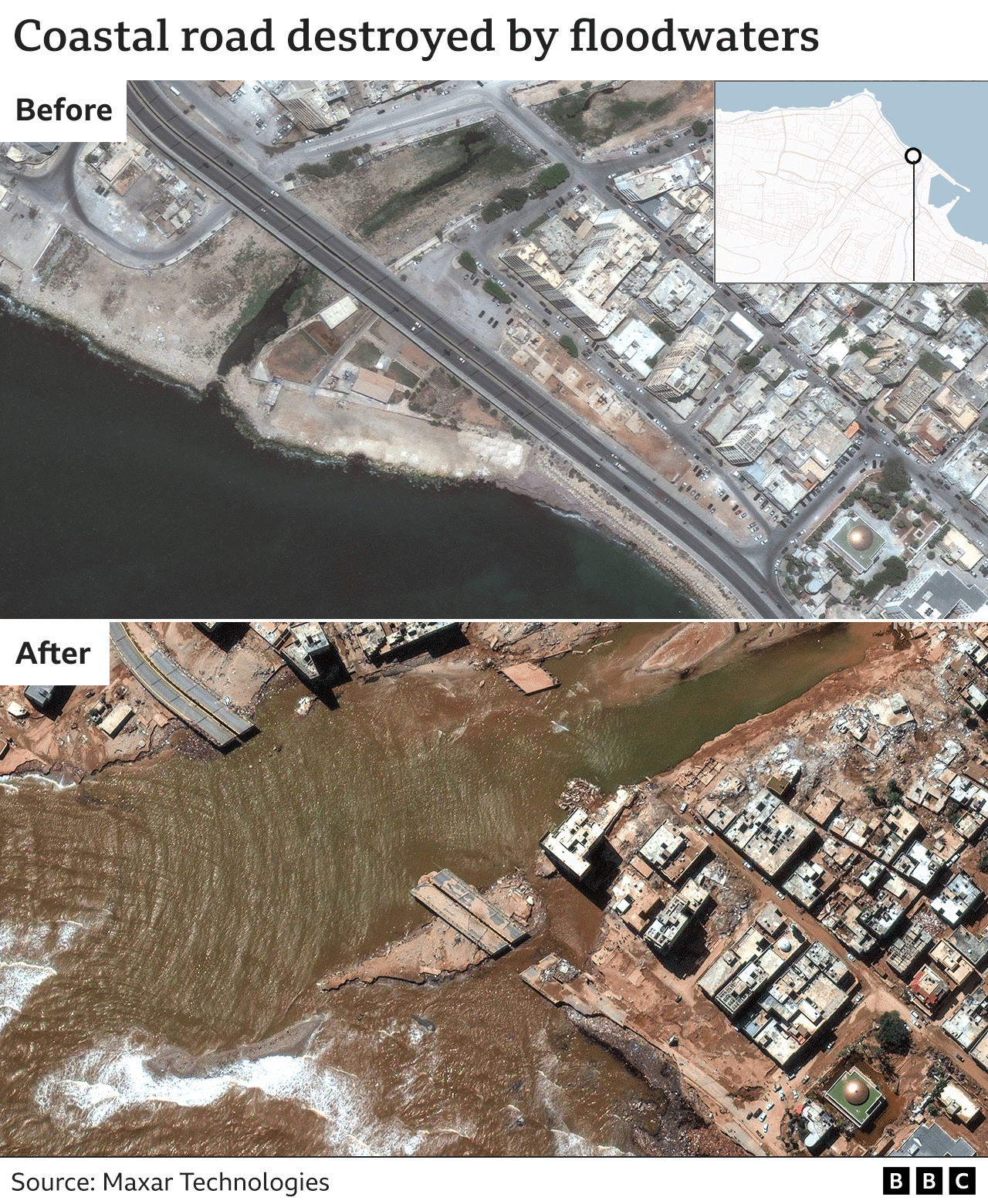
A major coastal road near the port has collapsed into the sea.
Derna's population was around 200,000 before the storm hit Libya.
The city's mayor said that given number of neighbourhoods completely destroyed, between 18,000 and 20,000 people may have died.
Thousands are also injured or missing, with many more left without anywhere to live.
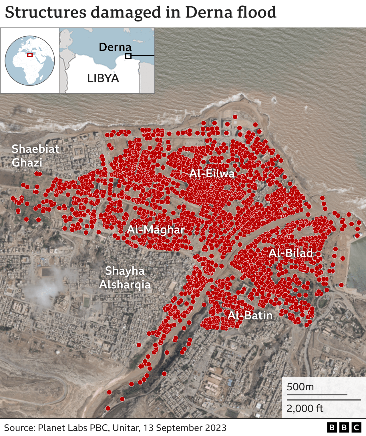
Analysis by the UN shows more than 2,200 buildings were exposed to rushing floodwaters and at least six bridges were damaged as well as the port area. Each red dot in the picture above represents one structure hit by flooding.
Severely affected neighbourhoods such as Al-Bilad and Al-Maghar on either side of the river were also home to healthcare facilities used by people from across the city, according to disaster analysts Reach.
Homes built in the dry riverbed on the sea side of the dam bore the brunt of the flood as the dams burst.
Hamad Shalawi, a former local official and member of the disaster committee, said the city was destroyed in seconds with whole families killed as residential buildings disappeared.
"The geography of the city has completely changed as half of the city has been swept into the sea," he told BBC Arabic.
Community facilities, including buildings around Darnes Football Club's home ground, were also destroyed or covered in layers of mud and debris.
Latest Stories
-
Komfo Anokye Blood Bank appeals for more donors amid fears of blood shortage due to rising road crashes
14 minutes -
National standardised test will identify learning gaps, not fail pupils – Dr. Apaak
34 minutes -
The AI infrastructure race is not the only race that matters
38 minutes -
2026 Ga Homowo Health Walk set for bigger show as Bills Micro Credit donates GH¢350,000
48 minutes -
71% of HR professionals say they are underpaid — SEDAT report urges action on pay inequity
54 minutes -
Africa’s future depends on moving people, skills and ideas across borders — Dr Yamson
1 hour -
Bright Future Alliance calls for stronger accountability in public and corporate institutions
1 hour -
Newsfile to discuss Wontumi’s jail term, Ofori-Atta’s US immigration win, Mid-Year Budget Review
1 hour -
Apinto chiefs demand equity stake in Gold Fields Tarkwa Mine as lease renewal talks continue
1 hour -
IJM Ghana trains child protection and justice professionals in trauma-informed care
1 hour -
Aggrieved assembly members to pass vote of no confidence against Ejisu MCE
2 hours -
Military reaffirms commitment to peace and national unity ahead of Teshie Homowo celebration
2 hours -
WAFCON 2026: Black Queens name final 25 players for tournament
2 hours -
Immigrants contribute 9% to South Africa’s GDP despite making up 6.5% of population — Report
2 hours -
Komfo Anokye Blood Bank appeals for more donors amid fears of blood shortage due to rising road crashes
2 hours