

Audio By Carbonatix
The Forestry Commission of Ghana has launched an enhanced map that segregates tree crops from natural forests anticipated to greatly contribute to accurate assessment of the forest cover, mitigation of the climate change impacts, tract commodity lead deforestation and overall ensure sustainable forest management.
It uses satellite data and cross referencing machine learning techniques to determine the extent and distribution of the forest cover and the rate of deforestation.
Dubbed, “Enhanced Land Use Land Cover Map of Ghana”, it does not only identify key commodity crops such as cocoa but also whether these crops are growing under the shade trees or growing under shade-free conditions.
The multipurpose product tool will be used to enforce compliance with zero deforestation commodities including cocoa, rubber, timber and oil palm sectors of Ghana.
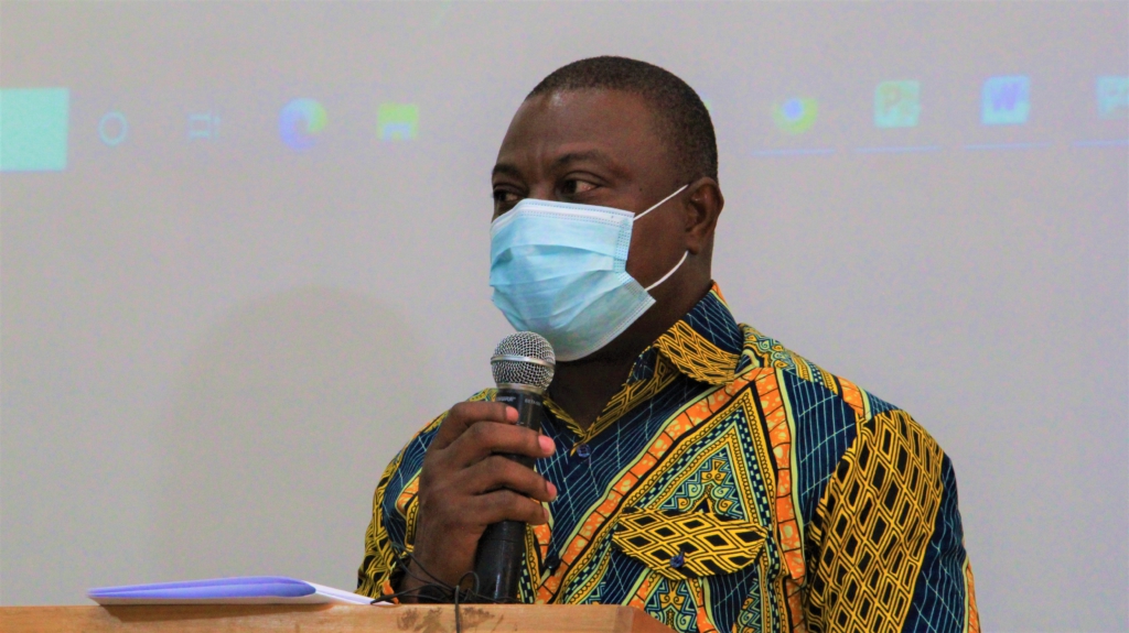
At the launch of the event in Accra, Chief Executive of the Forestry Commission, John Allotey said this represents a major breakthrough because it is the first third generation land use map produced at a national level by a developing country.
“The map has arrived at a time when Ghana is revising its forest reference and level and hoping to track both commodity led deforestation and legally produced timber. We are aware that similar maps have been developed through Forest 2020 in Mexico, Kenya, Columbia etc, but Ghana is the first country to achieve national coverage at this level of detail.”
Ghana is one of the participating countries that signed the Paris agreement in 2015. It is projected that the map will also be used to help report national climate change information under the UNFCCC under the Paris agreement.
Mr Allotey says the map will be updated overtime.
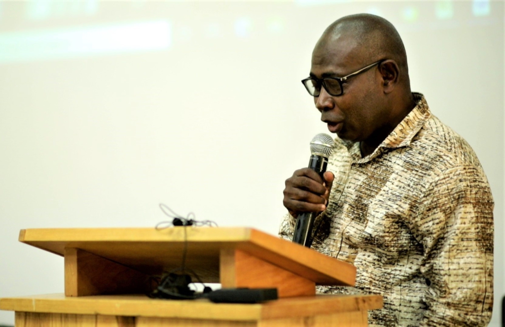
Head of Geo-information Unit at RMSC-Forestry Commission and Principal Investigator for Forests 2020 Project, Yakubu Mohammed, said the tool will be a useful one for all stakeholders in the forestry and cocoa sectors in Ghana.
“It will address the inconsistencies in the dissemination of forest information. It will feed into the estimation of Green House Gas emissions in the land sector and serve as baseline information for estimating the Ghana forest reference level”.
He said it was launched to develop procedures for mapping the land border of Ghana to address forest monitoring challenges.
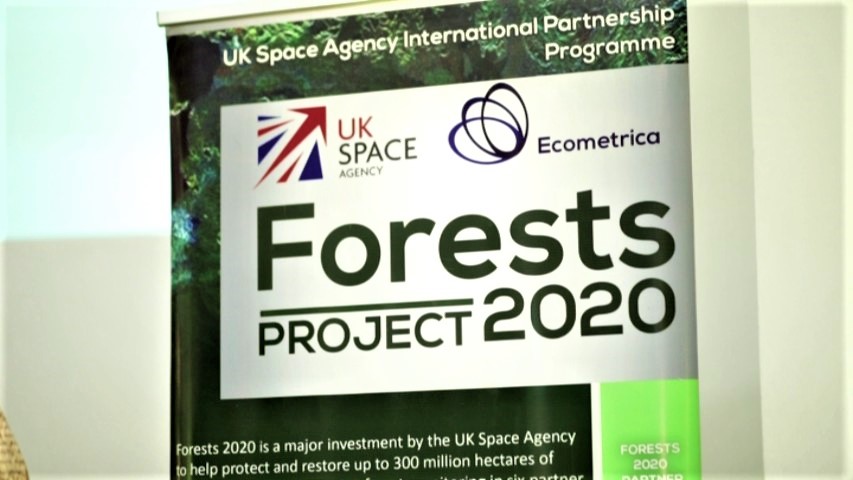
The project was a collaboration between academia and sector institutions with funding support from UK Space Agency, and another UK company called the Ecometrica Limited.
Faculty of Renewable Natural Resources of the KNUST and the Resource Management Support Centre of the Forestry Commission to executing the project in Ghana.
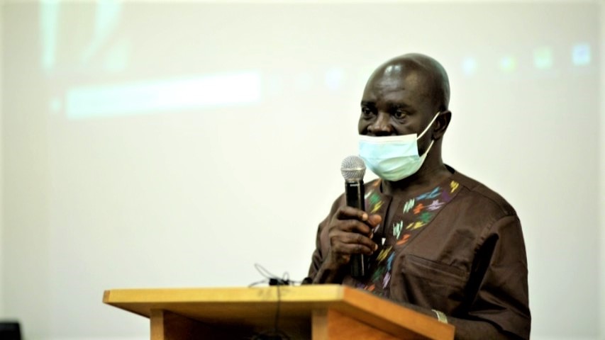
Dean of Faculty of Renewable Natural Resources, Professor Kyere Boateng, observes that the project has enabled the country to address one of the important challenges in the forestry sector.
“This project has helped us to hold on to the tradition of collaborating within country. It has also helped us to improve on our expertise in GIS, it is not only going to benefit us in our research but in our teaching too.”
He continued that, “The product is a novelty and so we are very happy to be part of this team. We are always available and ready to work with the necessary institutions and partners to ensure that the purpose for which this product was conceptualize will come to a reality.”
Mr Allotey reiterated that the Forestry Commission of Ghana is the custodian of the data, and that permission to use the map should be sought through the Chief Executive of the Commission.
“Any public, government and commercial use of this map will be supported by Ecometrica whose online distribution platforms will ensure that the correct version of the map is used at all time and it is within the right time frames,” he added.
The Commission thanked the UK space agency, Ecometrica, the technical wing of the Forestry Commission –Resource Support Center, Faculty of Renewable Natural Resources, and the Forest Research Institute of Ghana (FORIG) for the support.
Latest Stories
-
Ghanaian youngster Isaac Assibu signs new Malmo deal, earns first-team promotion
1 hour -
Prince Owusu completes four-year move to DAC 1904
2 hours -
When Politics Meets Perception: Will Ken Ofori-Atta return to Ghana?
4 hours -
Peace must be the hallmark of Homowo 2026 – DCOP Asiedu
5 hours -
‘Ghana lost a president, but I lost a mentor and a friend’ – Mahama pays tribute to Atta Mills
6 hours -
Ghana’s High Commissioner to UK commits to support Team Ghana at Commonwealth Games
6 hours -
Photos: Flood Mitigation Task Force begins phased dredging, demolition exercise in Accra
6 hours -
ICC top prosecutor removed over sexual misconduct allegations
6 hours -
Glasgow 2026: Ghanaian boxer Abdul Wahid Omar eliminated after unanimous points defeat to Patris Mughalzai
6 hours -
Ghana Gas CEO Judith Adjobah Blay earns Master of Laws degree from University of Nottingham
6 hours -
Gender Minister leads monitoring exercise to strengthen School Feeding Programme
6 hours -
Gov’t advocates capacity building for Ghana’s creative industry at interior design masterclass
6 hours -
Flood Mitigation Task Force begins phased dredging, desilting and demolition exercise across various locations in Accra
7 hours -
The Brotherhood: ‘Pastors should stop teaching that sex before marriage is wrong’ – MC Mr. Hanson
7 hours -
Komfo Anokye Blood Bank appeals for more donors amid fears of blood shortage due to rising road crashes
7 hours